As I have mentioned before, much of my research is in Maryland. In Maryland, all land records are on-line. That makes finding specific locations for my ancestors’ homes and businesses a little easier since it can be done from home. There are a lot of tools out there, free and paid, to help plot the information found in the deeds available on-line. But for my 5th great-grandfather Joshua Whitaker, someone else did much of the work, I just reap the rewards of his hard work!
If you have an early landowner in Baltimore or Harford County, Maryland you may want to check this out as well.
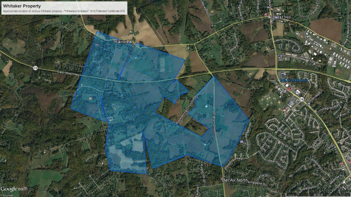
Below is the final result of my search, then I will talk about how I got there:

Step One – Finding THE Land Records
My original search involved searching https://mdlandrec.net/main/ for land records for Joshua Whitaker. Joshua was born in 1761, probably in Baltimore County, Maryland since Harford County was not formed until 1774. Joshua married Ruth Howard in 1781 at about aged 20, so I assumed I should start searching for him in the Harford County land records around 1780 or so. I found several deeds for Joshua Whitaker and I attempted to plot them out. Earlier land records are harder to plot (in my opinion) because the property line references are defined very differently than today. Many times the property lines are defined as a tree line or the edge of a stream, not necessarily as bearings and distances like they are now. So my progress was S-L-O-W.
Along with the MDLANDREC site, the Maryland State Archives has also made plats available on-line. So I also headed to plats.net and searched “Whitaker” (in the Advanced Search) to see what came up. Two of the records caught my eye:
- A Patented Certificate in 1819 for “Whitacres Invitation”
- An Equity Record from 1825 for “Property of the late Whitaker, Joshua”
My Joshua died in 1818 so the 1819 certificate was a head scratcher. But it was possible that the Equity Record could be for him.
Time to look at the actual documents. The document contained 9 pages but I will highlight 2 of them here.
Looking at the 1st image of the Patented Certificate it was possible that this was my Joshua. It was surveyed in 1815 and passed in 1816.

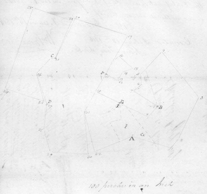
And page 3 had a plot of the land:

Then I looked at the Equity Record. I know from Joshua’s will that his property was to be divided between his wife and several of his children.

Cool! The basic outline of the 2 records match. And, referring back to the will, this is my Joshua.
So now I have a plot of the land that Joshua Whitaker owned but it will take a lot of work to put Joshua’s land on a current map to see exactly where this land was.
Step Two – Locate on today’s map
For a while I tried using the land records going forward in time to plot Joshua’s land in today’s landscape. It was frustrating and I was mostly unsuccessful.
And then I stumbled upon a simple looking ABSOLUTELY WONDERFUL website. One of the pieces of software I use to plot land is called DeedMapper from Direct Line Software. Besides the software, their site includes a Research Directory (so you can see others researching land records in an area) and a Deed Data Pool (customer contributed deed files). In looking at the Deed Data Pool I found a Baltimore County and a Harford County file contributed by Mike Pierce. Clicking on the Harford County file led me to a page containing the Deed Mapper file for Harford County. This was great because it allowed me to download the file and open it in the DeedMapper program with a background map.
But the really great part was when I went back to the base web address http://map-maker.org/ and saw everything Mike Pierce’s “The Happy Map-Maker’s Website”.
This site includes searching aids for Baltimore County and City, his aforementioned DeedMapper files, information on leases and land grants in Baltimore and Harford Counties and an animated progression of land grants in said counties. GREAT resources.
But the pièce de résistance is a Google Earth version of the Baltimore and Harford County leases and land grants. AAAAHHHHH! Since Google Earth is one of my most favorite tools, this is awesome!
So I opened the Harford County patents, downloaded the file and opened the KML file in Google Earth.
At first look the file is very busy and looks hard to navigate.

But by using the tools available in Google Earth I was able to isolate Joshua’s 1819 land patent.

This allowed me to export just Joshua’s land as a KMZ file and create standalone map placing Joshua’s land in today’s world.
THANK YOU MIKE!!


One thought on “Plotting My Ancestor’s Land on a Current Map”